Depression No-02/2024
Issued at (14:00) hours M.S.T on 24-5-2024
Depression Condition
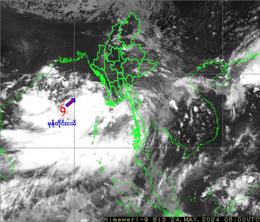
According to the observations at (12:30) hrs M.S.T today, a depression over Central Bay of Bengal has moved Northeastwards and it is centered at about (280) Nautical miles West-Northwest of Coco Island, (330) Nautical miles West-Southwest of Hainggyigyun, (370) Nautical miles West-Southwest of Gwa, (375) Nautical miles West-Southwest of Thandwe (Myanmar), (400) Nautical miles South-Southwest of Khepupara (Bangladesh) and (410) Nautical miles South of Canning (West Bangal, India).
It is not moving towards Myanmar coasts, the present stage of the Depression is coded yellow stage.
Position of Depression, center pressure and wind
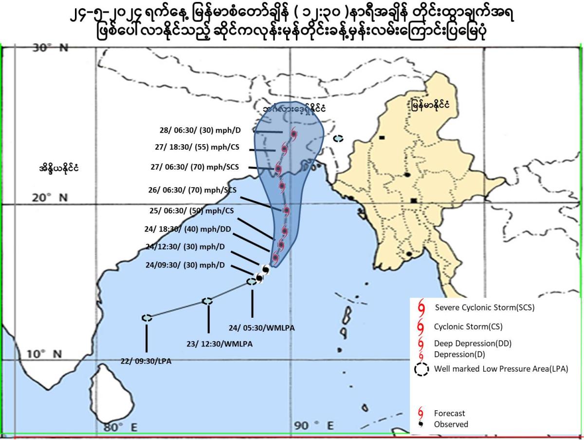
The Depression is located at Latitude (15.5) degree North and Longitude (88.7) degree East, centre pressure of Depression is (996) hPa and maximum wind speed near the center is (30) miles per hour at (12:30) hrs MST today.
During next (72) hrs forecast
The Depression is likely continue to move initially Northestwards and further intensify into a Cyclonic Storm over Eastcentral Bay of Bengal on 25-5-2024 morning. Thereafter it is likely continue to move Northwards and intensify into a Severe Cyclonic Storm on 26-5-2024 morning. It may cross Khepupara (Bangladesh) and adjoining West Bengal coasts near Sagar Island (India) on 27-5-2024 early morning.
General caution
Under the influence of depression, rain or thundershowers will be fairly widespread to widespread in Naypyitaw, Sagaing, Mandalay, Magway, Bago, Yangon, Ayeyarwady, Taninthayi Regions and Kachin, Chin, Rakhine, Kayin, Mon States with likelihood of regionally and isolated heavyfalls in some Regions and States along with strong winds from today afternoon to 27-5-2024. Occasional squalls with rough seas will be experienced in Gulf of Mottama, off and along Mon-Taninthayi Coasts. Surface wind speed in squall may reach 40-45 mph and wave height will be about 9-12 feet from 24-5-2024 to 25-5-2024. Frequent squalls with rough to very rough seas will be experienced in Deltaic, off and along Rakhine Coasts. Surface wind speed in squall may reach 40-45 mph and wave height will be about 9-13 feet from 24-5-2024 and surface wind speed in squall may reach 50-60 mph and wave height will be about 13-16 feet from 25-5-2024 to 26-5-2024.
Advisory
Under the influence of depression, people should be awared heavy rain with strong wind, flash flood and landslide in the hilly areas and near small rivers and also domestic flight, trawlers, vessels and ships off and along Myanmar Coasts.